Geosys AI
Go Beyond Data Delivery. Transform Geospatial Data with AI-Powered Analytics Platform
Enable interactive analysis, GeoAI-driven insights, and a seamless client experience in one unified platform.
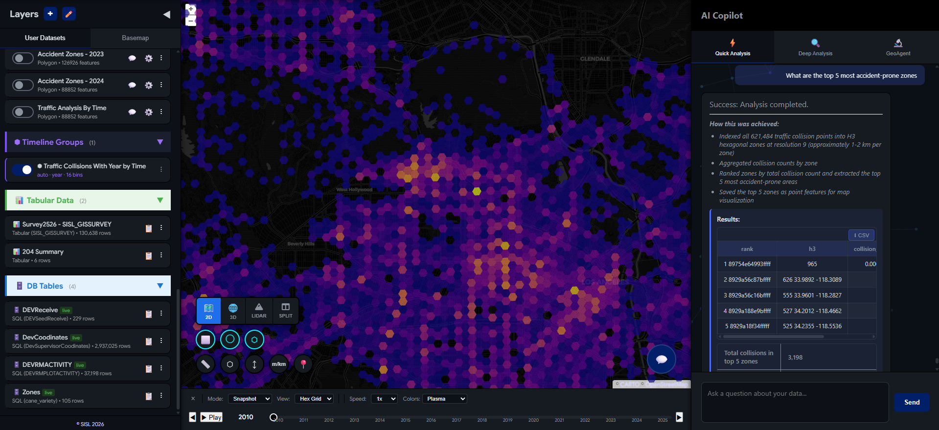
From Data Delivery to Intelligent Analytics Experience
No scripts. No queries.
The GIS platform that speaks your language.
Go Beyond Data Delivery. Deliver an Experience.
Advanced Geospatial Analytics with GeoAI — Deliver to Your Clients, Instantly
Describe your task in plain language. Geosys AI understands it, runs the spatial analysis, and delivers results as ready-to-use map layers. Turn your geospatial deliverables into interactive, browser-based portals your clients can explore — no software installs, no training, no waiting.
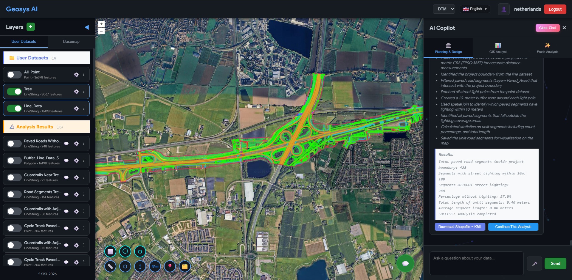
Agentic Workflows — GeoAgent
No blind automation. GeoAgent understands, clarifies, then executes.
- Asks clarifying questions before running analysis
- Lets you choose datasets, metrics, and outputs
- Builds a transparent, step-by-step workflow
- Allows you to edit, customize, and extend the logic
- Save workflows and reuse them across projects
From "Classify road segments by lighting" to a full analysis pipeline — data sourcing, spatial joins, calculations, and classification. All visible. All editable. No black box.
Explore GeoAgentUser asks
"Classify road segments based on how well they are lit"
GeoAgent clarifies
Which lighting dataset? Buffer radius? Classification method?
Builds workflow
Data sourcing → Spatial join → Calculate scores → Classify
You customize
Edit thresholds, swap datasets, adjust classification logic
Save & reuse
Save as a reusable workflow template for your team
All Your Data, One Intelligent Platform
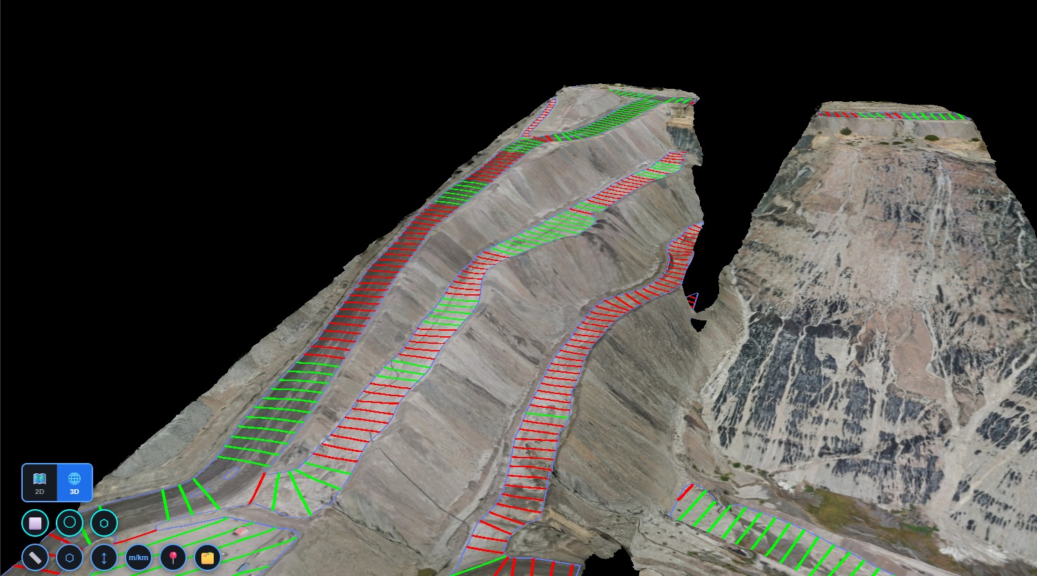
Bring together orthophotos, satellite imagery, vector datasets, LiDAR, 3D models, and street-level imagery — all in a single, unified environment. Analyze across formats. Visualize everything together. Unlock deeper insights without switching tools.
White-Labelled Platform
Deploy Geosys AI under your own brand — custom logo, domain, and colors. Fine-grained permissions let you control access per project.
Cost-Effective Pricing
View GIS data, orthophotos, LiDAR point clouds, and 3D models — all under a single, cost-effective subscription. No separate licenses for heavy desktop GIS software, no per-seat viewer fees. One platform replaces an entire toolchain.
Everything included:
Three steps. That's it.
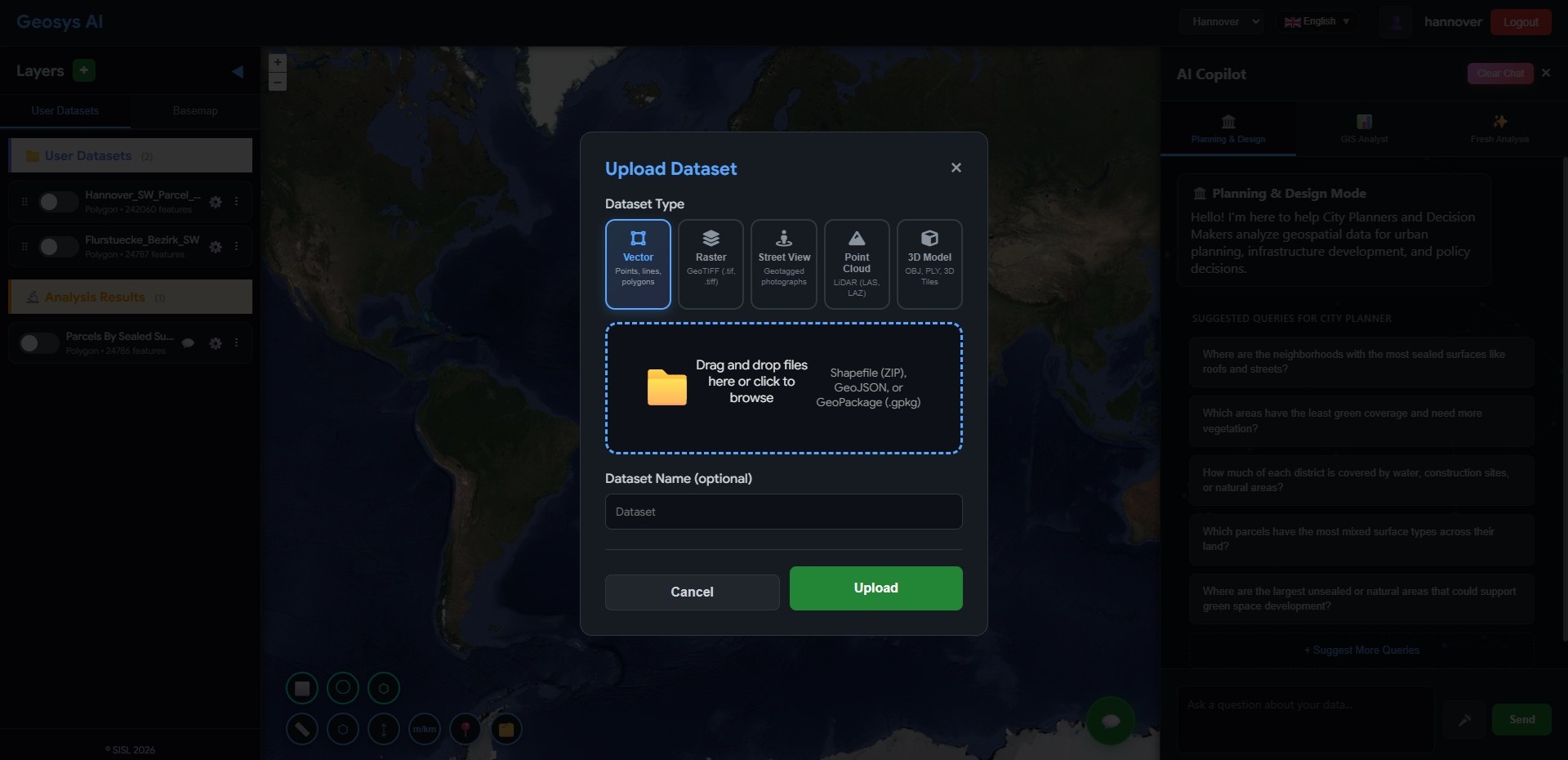
Upload Your Data
Shapefile, GeoTIFF, KML, GeoJSON — drag and drop any geospatial format. Your data is ready in seconds.
Ask a Question
plain language, no code needed. Describe what you want to analyze and the AI Copilot handles the rest.
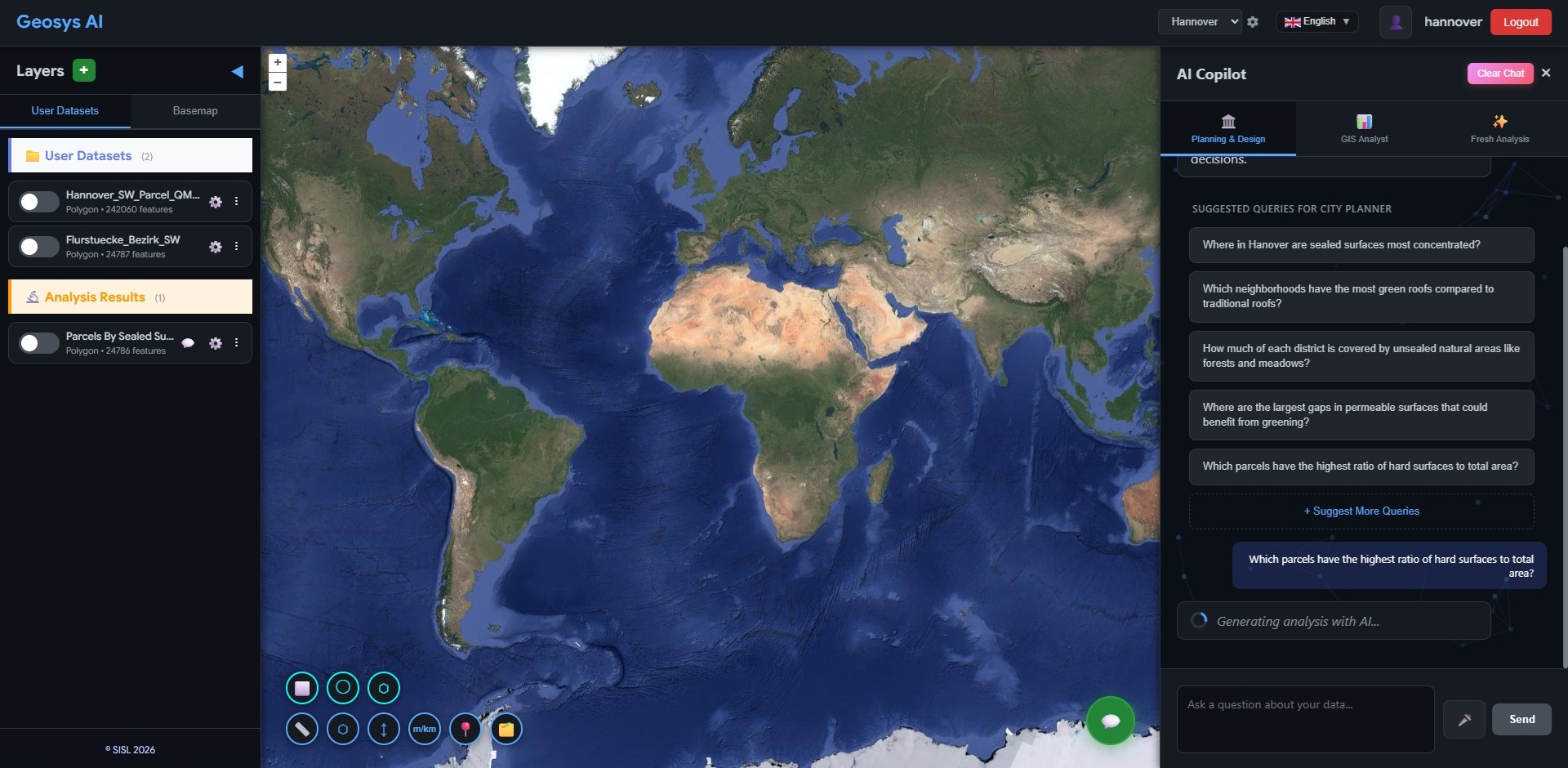
Get a Live Map Result
Styled layer on your map — shareable, interactive, and ready for decision-making.
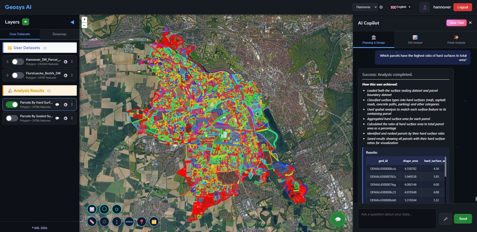
Everything you need in one platform
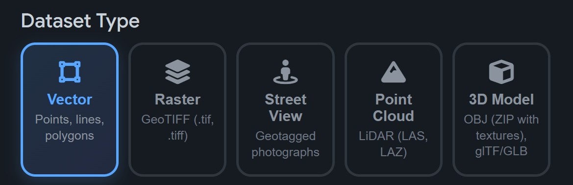
Upload Any Format
Upload vector (Shapefile, GeoJSON, GeoPackage), raster (GeoTIFF), LiDAR (LAS/LAZ), and 3D models (OBJ, glTF) — all from one drag-and-drop interface.
Ready to deploy?
Get a demo, pricing, and a pilot plan tailored to your data stack.